Sentinel-3 (L2)
Overview
The Sentinel-3 mission provides global multispectral imagery at a resolution of 300m-500m, with a revisit time of approximately two days, from 2016 to the present.
This dataset represents a global archive of the Sentinel-3 Level 2 products derived from the following Sentinel-3 instruments:
- OLCI (ocean and land color instrument) (300m resolution)
- SLSTR (sea and land surface temperature radiometer) (500m resolution)
- SRAL (SAR radar altimeter) (300m resolution)
This dataset also includes the Sentinel-3 Synergy products that are derived from the OLCI and SLSTR instruments.
Sentinel-3 data on Azure are maintained by Sinergise.
Sentinel-3 data are currently in preview on Azure; email aiforearthdatasets@microsoft.com to request access.
Storage resources
Container information
Data are stored as NetCDF files in Azure Blob Storage in the West Europe Azure region, in the following blob container:
https://sentinel3euwest.blob.core.windows.net/sentinel-3
Scene names
Within that container, each scene corresponds to a folder, named according to:
[instrument]/[product]/[year]/[month]/[day]/[scene_name]
instrumentis one ofOLCI,SLSTR,SRAL, orSYNERGY(see instrument names above)-
productis a product identifier, one of the following (each appears only in the folder for the corresponding instrument):OL_2_LFR___: full-resolution land color (vegetation) and atmosphere parameters (from the OLCI instrument)-
OL_2_WFR___: full-resolution ocean color and atmosphere parameters (from the OLCI instrument) SL_2_FRP___: fire radiative power (from the SLSTR instrument)SL_2_LST___: land surface temperature (from the SLSTR instrument)-
SL_2_WST___: sea surface temperature (from the SLSTR instrument) SR_2_LAN___: land altimetry (from the SRAL instrument)-
SR_2_WAT___: ocean altimetry (from the SRAL instrument) SY_2_AOD___: aerosolSY_2_SYN___: surface reflectance and aerosol parameters over landSY_2_V10___: 10-day surface reflectances and NDVISY_2_VG1___: 1-day surface reflectances and NDVISY_2_VGP___: vegetation-like product
yearis the four-digit yearmonthis the 1-indexed, zero-padded monthdayis the 1-indexed, zero-padded day of month
scene name follows the Sentinel-3 naming convention, which is consistent across instruments, but is documented separately for OLCI, SLSTR, SRAL, and SYNERGY products:
MMM_OL_L_TTTTTT_yyyymmddThhmmss_YYYYMMDDTHHMMSS_YYYYMMDDTHHMMSS_[instance ID]GGG[class ID].SEN3
MMMis the mission indicator (S3A or S3B, or S3_ for combined products)OLis the source instrument (OL, SL, SR, or SY for OLCI, SLSTR, SRAL, or SYNERGY, respectively)Lis a processing level, always 2 in this datasetTTTTTTis the product ID, and should match the last six characters of the product component of the folder nameyyyymmddThhmmssis the sensing start time for this scene (Tis the character ‘T’)YYYYMMDDTHHMMSSis the sensing stop time for this scene (Tis the character ‘T’)[instance ID]is a 17-character tile identifier, formatted asDDDD_CCC_LLL_FFFF(see documentation for infrequent cases where the instance ID format deviates from this convention):DDDD: duration of the sensing interval in secondsCCC: cycle number at the sensing start timeLLL: relative orbit numberFFFF: frame number
GGGidentifies the processing center that created this product[class ID]is the classification of this product, formatted asP_XX_NNN:P: platform status (O for operational, F for reference, D for development, R for reprocessing)XX: timeliness of the processing workflow (NR for near real time, ST for short time critical, NT for not time critical)NNN: baseline collection
- .SEN3 is a fixed extension
Putting that all together, the following is a complete URL to a folder containing an OLCI product from April 2, 2019
https://sentinel3euwest.blob.core.windows.net/sentinel-3/OLCI/OL_2_LFR___/2019/04/02/S3A_OL_2_LFR____20190402T000107_20190402T000407_20190403T034838_0179_043_116_1800_LN1_O_NT_002.SEN3/
Image files
Each scene folder may contain several NetCDF files. See the complete product specifications for details of all files (OLCI land, SLSTR, FRP, SRAL, SYN, summary, and OLCI water) but some frequently-used files for each product are listed here.
Key OLCI land (OL_2_LFR) data files
ogvi.nc: global vegetation index (“Fraction of Absorbed Photosynthetically Active Radiation (FAPAR) in the plant canopy”)otvi.nc: terrestrial chlorophyll index (“Estimates of the Chlorophyll content in terrestrial vegetation, aims at monitoring vegetation condition and health”)ivw.nc: water vapor (“Total amount of water vapour integrated over an atmosphere”)-
rc_ogvi.nc: red/NIR rectified reflectances, approximates top of canopy reflectance geo_coordinates.nc: lat/lon coordinates for each pixeltime_coordinates.nc: timestamp (should match the scene name)
Raw reflectance data is not included in the OL_2_LFR product; see the SYN product below for land surface reflectance information.
Key OLCI ocean (OL_2_WFR) data files
chl_nn.nc,chl_oc4me.nc: chlorophyll concentration (via neural network, oc4me algorithms)iop_nn.nc: absorption of colored detrital and dissolved material at 443nm (ADG_443_nn) (neural-network-derived)iwv.nc: atmospheric water vaporOa0N_reflectance(N from 1 to 21): surface reflectance values (band documentation)par.nc: photosynthetically active radiation from 400nm-700mtrsp.nc: diffuse attenuation coefficient for down-welling irradiance at 490nm (KD490) (ocean water clarity)tsm_nn.nc: total suspended matter concenstration (via neural network)-
w_aer.nc: aerosol load geo_coordinates.nc: lat/lon coordinates for each pixeltime_coordinates.nc: timestamp (should match the scene name)
Key fire radiative power (SL_2_FRP) data files
geodetic_fn.nc: lat/lon coordinates for each pixel (alternative coordinate systems are provided as well)frp_in.nc: 1km fire radiative power measurement
Key land surface temperature (SL_2_LST) data files
geodetic_fn.nc: lat/lon coordinates for each pixel (alternative coordinate systems are provided as well)lst_in.nc: 1km fire radiative power measurement
Key ocean surface temperature (SL_2_WST) data files
This product contains only a single NetCDF file per scene, containing the following key variables (not an exhaustive list):
- lat, lon, time
- SST (sea surface temperature)
Key land altimetry (SR_2_LAN) data files
The only files contained in an SR_2_LAN scene are standard_measurement.nc, enhanced_measurement.nc, and reduced_measurement.nc, containing the standard surface height measurements, additional information, and a subset of the standard measurements, respectively.
Key ocean altimetry (SR_2_WAT) data files
The only files contained in an SR_2_WAT scene are standard_measurement.nc, enhanced_measurement.nc, and reduced_measurement.nc, containing the standard surface height measurements, additional information, and a subset of the standard measurements, respectively.
Key synergy (combined OLCI/SLSTR) aerosol (SY_2_AOD) data files
This product contains only a single file per scene, called NTC_AOD.nc, containing all aerosol measurement data and associated metadata (e.g. spatial coordinates).
Key synergy (combined OLCI/SLSTR) land surface reflectance (SY_2_SYN) data files
geolocation.nc: georeferencing dataSyn_Angstrom_exp550.nc: aerosol Angstrom exponentSyn_AOT550.nc: aerosol optical thicknessSyn_OaNN_reflectance.nc(NN from 01 to 21): surface reflectance from the OLCI instrument (band documentation)Syn_SnO_reflectance.nc(n in [1,2,3,5,6]): surface reflectance from the SLSTR instrument, oblique view (band documentationSyn_SnN_reflectance.nc(n in [1,2,3,5,6]): surface reflectance from the SLSTR instrument, nadir view (band documentationtime.nc: timestamp
Key synergy (combined OLCI/SLSTR) vegetation-like product (SY_2_VGP) data files
B0, B2, B3, and MIR are spectral bands corresponding to 450nm, 645nm, 835nm, and 1665nm, respectively (blue, red, near-infrared, and mid-infrared).
Key files:
B0.nc,B2.nc,B3.nc,MIR.nc: reflectance data for the B0, B2, B3, and MIR bands, respectively (including geometry)
Key synergy (combined OLCI/SLSTR) 10-day surface reflectance and NDVI (SY_2_V10) data files
A scene folder for all previous products corresponds to an image with non-geographically-relevant boundaries; for the V10 and VG1 products, a scene folder contains one of AFRICA, NORTH_AMERICA, SOUTH_AMERICA, CENTRAL_AMERICA, NORTH_ASIA, WEST_ASIA, SOUTH_EAST_ASIA, ASIAN_ISLANDS, AUSTRALIASIA, or EUROPE.
B0, B2, B3, and MIR are spectral bands corresponding to 450nm, 645nm, 835nm, and 1665nm, respectively (blue, red, near-infrared, and mid-infrared).
Key files:
B0.nc,B2.nc,B3.nc,MIR.nc: reflectance data for the B0, B2, B3, and MIR bands, respectively (including geometry)NDVI.nc: NDVI (normalized difference vegetation index) data (including geometry)
Key synergy (combined OLCI/SLSTR) 1-day surface reflectance and NDVI (SY_2_VG1) data files
Same as for SY_2_V10.
Sample code
A complete Python example of accessing and plotting Sentinel-3 data is available in the accompanying sample notebook.
Region information
Large-scale processing is best performed in the West Europe Azure region, where the images are stored.
Pretty picture
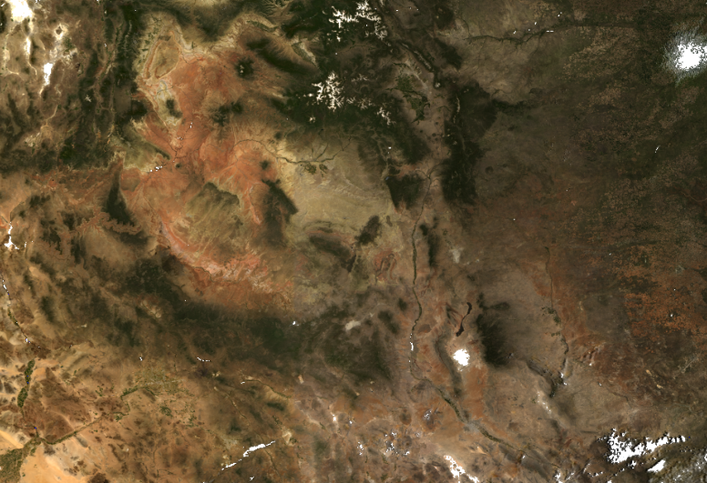
RGB composite of OLCI imagery from the Grand Canyon in 2019.
Contact
For questions about this dataset, contact aiforearthdatasets@microsoft.com.
Notices
Microsoft provides this dataset on an “as is” basis. Microsoft makes no warranties (express or implied), guarantees, or conditions with respect to your use of the dataset. To the extent permitted under your local law, Microsoft disclaims all liability for any damages or losses - including direct, consequential, special, indirect, incidental, or punitive - resulting from your use of this dataset. This dataset is provided under the original terms that Microsoft received source data.